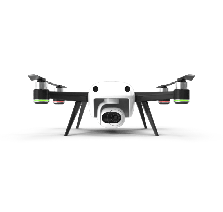
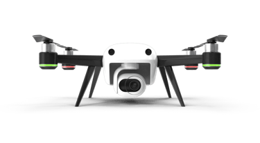
Transforming Data Acquisition with Drones
Faster, safer, and cost-effective drone solutions for various industries.
Rated 5 star by clients
★★★★★
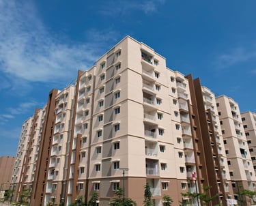
Innovative Drone Solutions for Industries & Real-Estate
At drony.in, we harness drone technology for efficient data acquisition and analysis across construction, infrastructure, and real estate sectors.
Who We Are?
At drony.in, we are a team of DGCA-CERTIFIED DRONE PILOTS with a singular mission: to deliver the best aerial services in Hyderabad. Our extensive experience and passion for drone technology drive us to provide top-tier solutions, whether it's aerial photography, mapping, or inspections.
Our services
At drony.in, we revolutionize how you see the world!
Aerial Photography & Videography
Whether it's a real estate project, or a cinematic project, we guarantee mesmerizing footage that showcases the full scale and beauty of your subject.


Drone Mapping & Surveying
Get detailed and accurate land data with our state-of-the-art drone surveying technology.
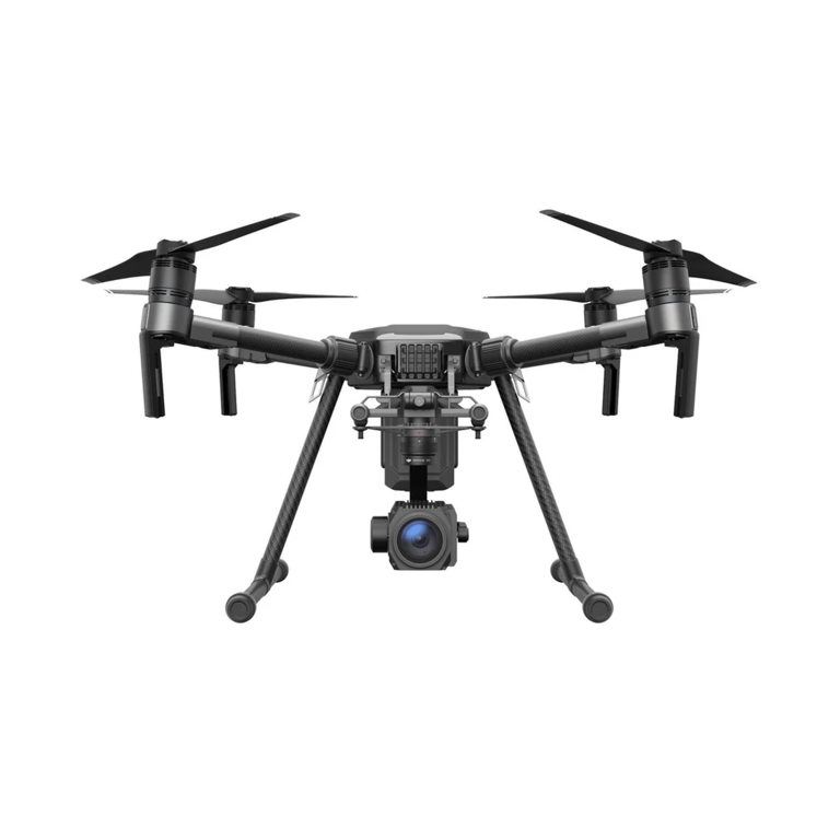
From industrial inspections to surveillance, our drones are equipped with the latest technology to deliver real-time data and high-quality images, ensuring safety, reliability, and efficiency.
Inspections & Surveillance
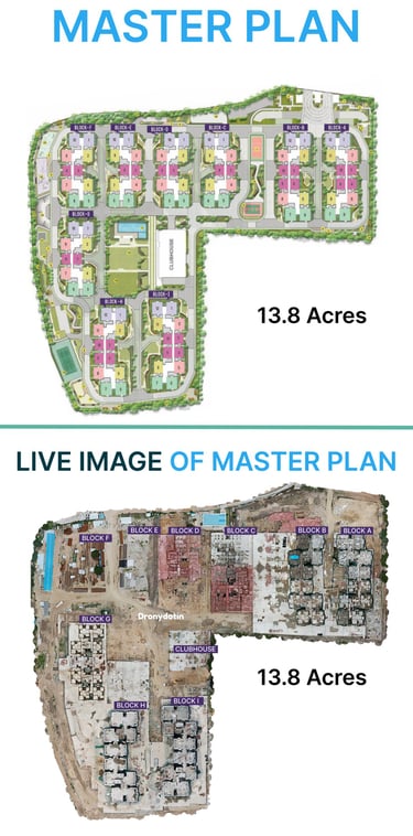
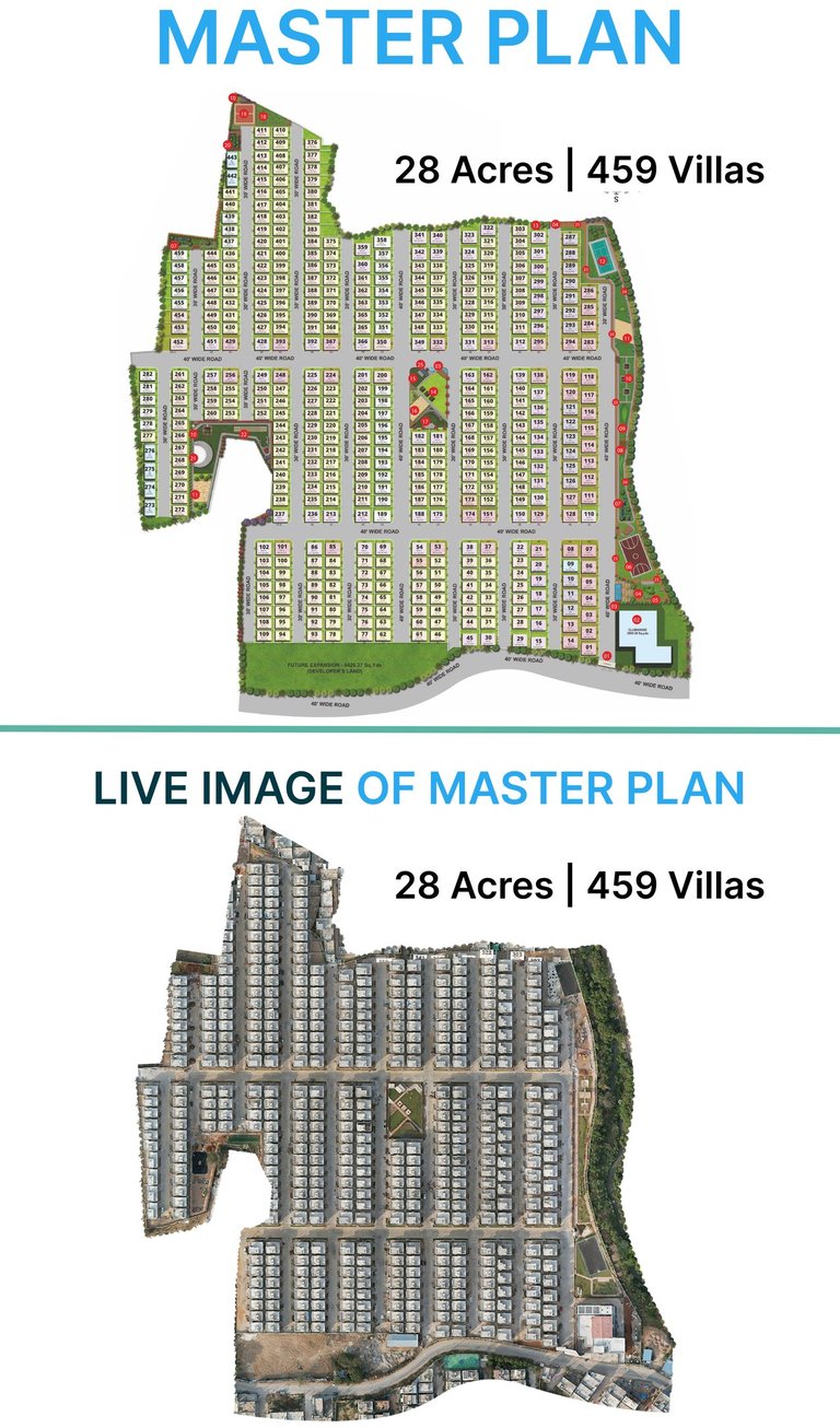
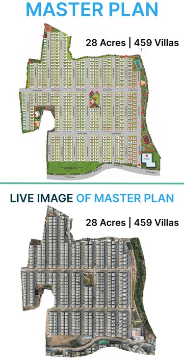
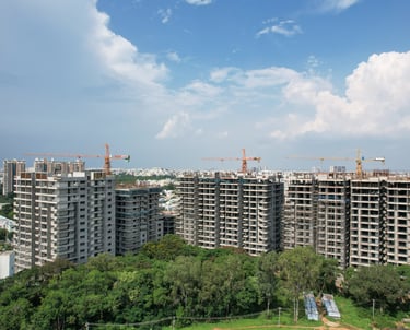
Build a 3D Model of Your Construction Site
Take your construction project to the next level with drony.in’s 3D modeling services. Our advanced drone technology allows us to capture detailed aerial data, transforming it into highly accurate 3D models of your construction site.

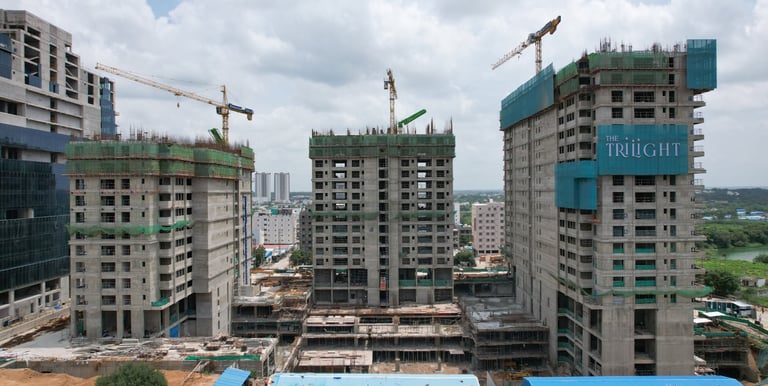
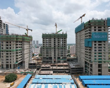
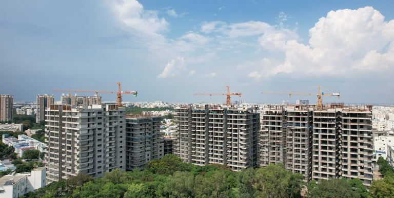
DRONE CONSTRUCTION PROGRESS TRACKING
Our drones capture real-time construction updates, giving you clear visuals of every stage—from foundation to finishing. Accurate, efficient, and hassle-free monitoring, anytime, anywhere.


Showcase Your Project Using 3D Superimposition
Give your clients a clear and realistic preview of their future investment, helping them see the full potential of your project right from the start!

DRONE ROUTE MAP
With a defined drone route map, we ensure smooth aerial shots that highlight every detail of your project—from entry to elevation—delivering a clear and complete visual story.

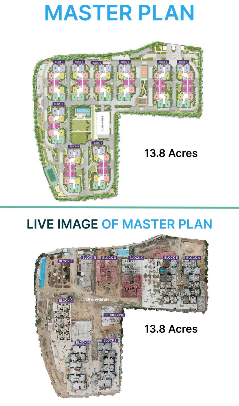
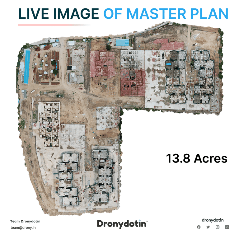
Orthomosaic Mapping
Precision Like Never Before
Whether you’re looking to measure areas, assess topography, or monitor project progress,
Our orthomosaic maps provide the precision and clarity you need to make informed decisions.
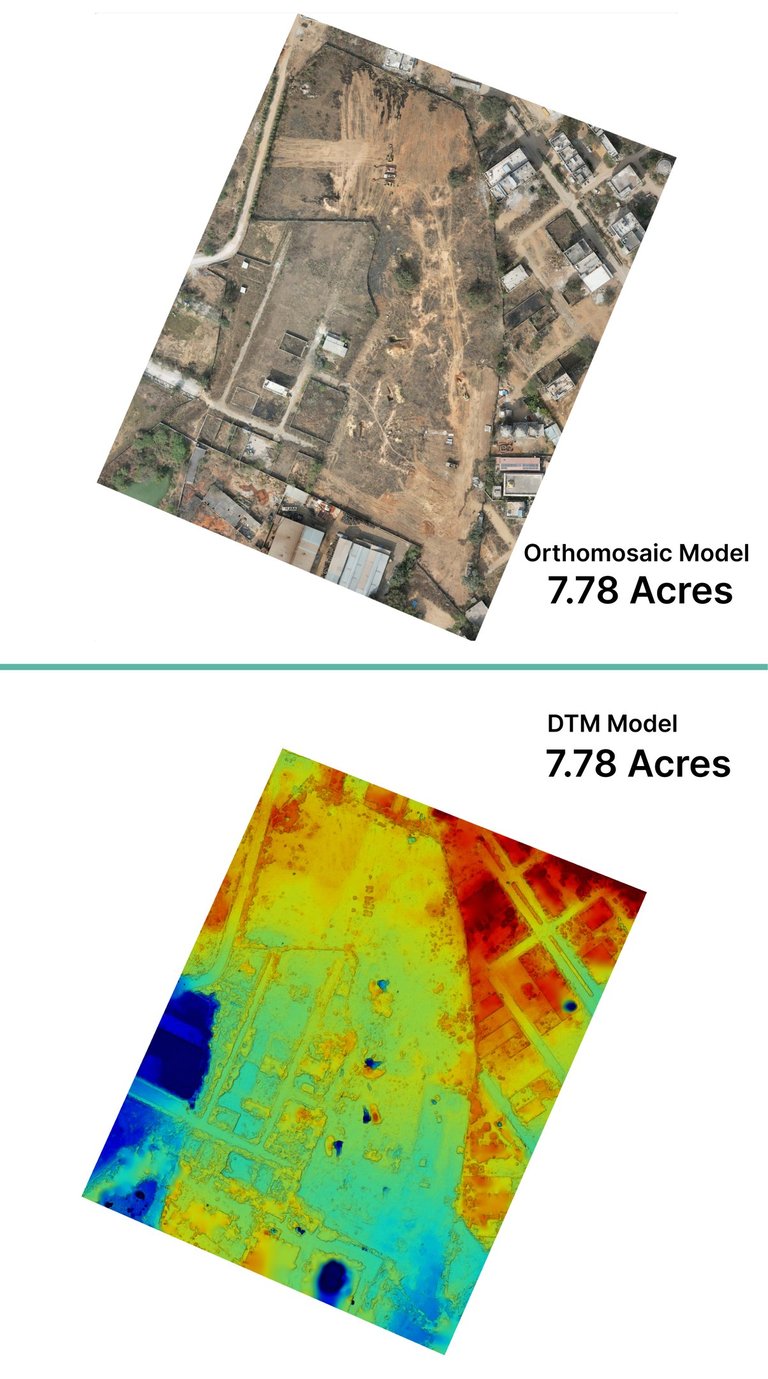
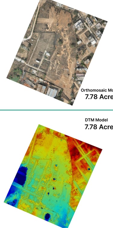
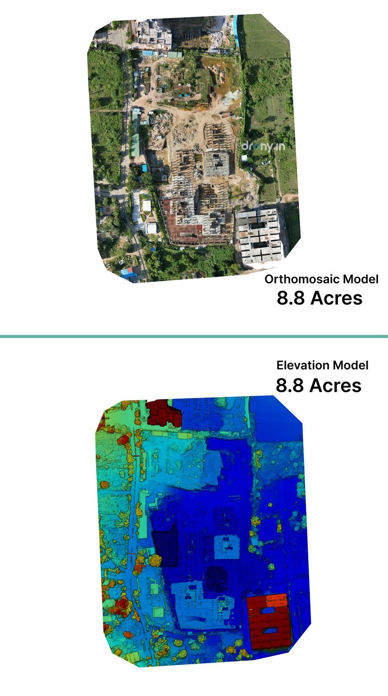
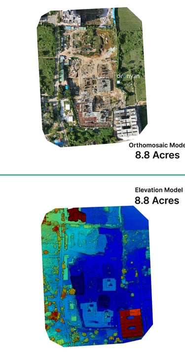
Digital Terrain Models (DTM) & Elevation Modeling
Get precise topographical data for your projects.
Our advanced drone technology captures accurate terrain and elevation details, enabling better planning, analysis, and decision-making.
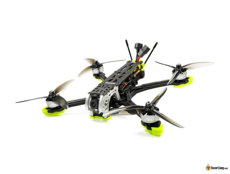
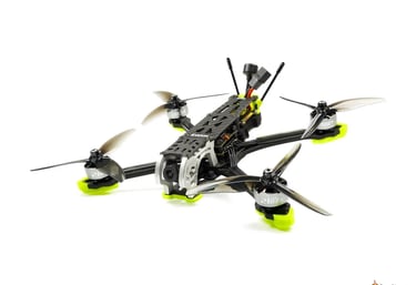
Drone Repairs
From minor fixes to major repairs, our experts bring your drone back to flying condition—fast, reliable, and hassle-free.
WE OPERATE ONLY IN GREEN ZONES
At drony.in, safety and compliance are our top priorities.
OUR CLIENTS


Look What Our Customers Say About Our Services
From Real estate developers to Surveyors, see how our aerial solutions have helped businesses and individuals achieve stunning results.
The team at dronydotin is highly professional. They arrived on time, were well-prepared, and maintained a friendly yet efficient demeanor throughout the shoot. Their attention to detail and commitment particularly impressive.
Tarun has delivered exceptional results, capturing stunning aerial footage and exceeding our teams expectations.
Outstanding work drony.in. Looking forward to work with you.